
Traditionally, single point measurements like calibrated tapes were used for measurements in architectural and construction works. Such tools produce inconsistent measurement, which varies from person to person leading to inaccurate concepts and results. These were also time-consuming tools.
At present, there are multiple specialized software and digitized technologies to bring an object from the real world into the digital 3D space with high geometrical accuracy and structural consistency.
What is 3D laser scanning survey?
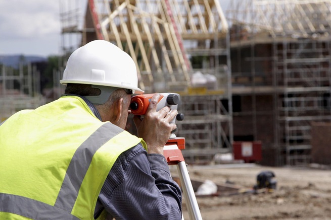
3D laser scanning survey is the latest technology and advance surveying method used to capture the spatial details of any 3D structure using a 3D laser scanning process. It is considered to be a fast and accurate way of gathering dimensional and spatial data required to plan and design an engineering project.
A 3D laser scanning process uses a high-definition laser scanner to capture precise geometric data and convert it into a 3D model.
The 3D laser scanning surveyors uses this 3D model to plan and study any structure. It also helps them to find any structural faults that might have developed during construction or over a span of time.
What is 3D laser scanning?
3D laser scanning uses LIDAR technology (Light, Imaging, Detection, And Ranging) to emit huge rays of energy, usually in the form of lasers, to capture the precise 3D geometry of an object and generate an exact digital 3D model of it using a 3D imaging software.
The rays emitted from the 3D scanner reflect back to the scanner after a collision with the surface.

Image Credit: https://www.istockphoto.com/photo/modern-device-makes-topographic-measurements-with-laser-total-center-gm1138793679-304160512
This technology calculates the 3D geometric data using three different working principles to accurately define the object’s position in space. Its three typical working principles are time-of-flight, phase-shift, and triangulation methods.
3D laser scanners can capture the geometrical data of an object with high accuracy without any physical contact, and regardless of its surface features and dimensions.
3D Laser scanning technologies are used in a wide variety of applications like reverse engineering, quality inspection, forensics, construction or civil engineering, archaeology, and mobile mapping systems.
What are the advantages of 3D laser scanning surveys?
3D laser scanning helps the surveyor to generate the actual digital drawings of a complex or inaccessible building or any other structures using laser light technology and 3D imaging software.
The 3D laser scanner generates these drawings from the on-site structural surveys of the infrastructure. These drawings are represented in multi-hued colour or true colour on a digital platform.

Image Credit: https://www.istockphoto.com/photo/modern-device-makes-topographic-measurements-with-laser-total-center-gm1171264108-324424864
The accuracy and high-speed of 3D laser scanning helps the surveyor to reduce structural errors or defects to avoid any accidents and injuries at construction sites.
Here are some other advantages of 3D laser surveying:
- It is efficient, faster and easier method for any structural surveys without physically accessing it.
- It provides much more accurate data of your project to determine its detailed features or specifications.
- It helps you to complete your project in a timely manner.
- Structural damages can easily be detected to avoid risk of any accidents.
- It provides structural data useful for demolition and renovation.
- It helps to reconstruct or repair old buildings or heritage monuments without demolishing or touching them. This avoids the risk of any damage that may occur to them.
